

PGTEK creates turnkey geospatial applications that optimize our customer’s decision process. From creating applications that assists the warfighter to navigate safely in a hot zone to determining the impact of flooding on a country’s crop output, our geo solutions add value and are applicable to every market segment.
Development of a typical PGTEK geospatial application involves advanced systems architecture. Our applications are based on data and intelligence fusion using mash up technologies that are pulling from a dynamic set of data sources. We create scripts and code using APIs and leading edge geographical, analytical, and statistical tools. Geo files are created, edited, and or combined for use in viewing platforms such as Google Earth, ESRI, and Microsoft BING Maps.
Our Geospatial and Analytic Solutions include:

Targeting & POI Analysis
Trends & Predictive Analysis
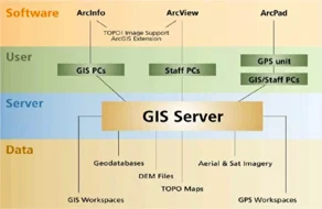
Geo-Systems Engineering & Integration

Training
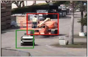
Video Analytics
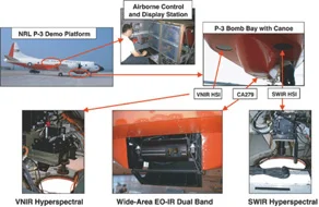
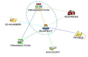
Multi-Int Fusion
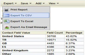
Data Mining & Visualization
Data Cleansing & Preparation
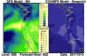
Weather-Based Analysis

Geosocial Mediasm

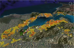
3D Visualization
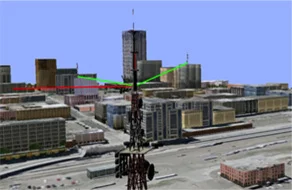
Wireless/Signals Propagation Analysis